Season 1

Works done by the Expedition in 2017 were done basing on the license, dated 23.01.2017, given by the Director General of National Corporation for Antiquities & Museums (NCAM) – Dr. Abdelrahman Ali Mohamed to Dr. Mirosław Masojć, University of Wrocław, Poland as well as to Al Neelian University and NCAM.

During the first season of the expedition (2017) the recognition of geology of the area was the main goal. On the following sites the work were in progress: EDAR 6; EDAR 7; EDAR 96; EDAR 133; EDAR 134; EDAR 135

Additionally some works were done on the profile located near the site EDAR 7. The profile was named GEO Profile 3.

Fig. 1. Site EDAR 6, trench I/2017 from the air. Site at the initial stage of investigations
Fig. 2. Site EDAR 6, trench II/2017. Below the brown sandy silt layer a gravel and boulder horizon with Acheulean artifacts visible
Fig. 3. Site EDAR 7, profile I (western). Works in progress. Sedimentological descriptions, OSL, AMS sampling

Site EDAR 6

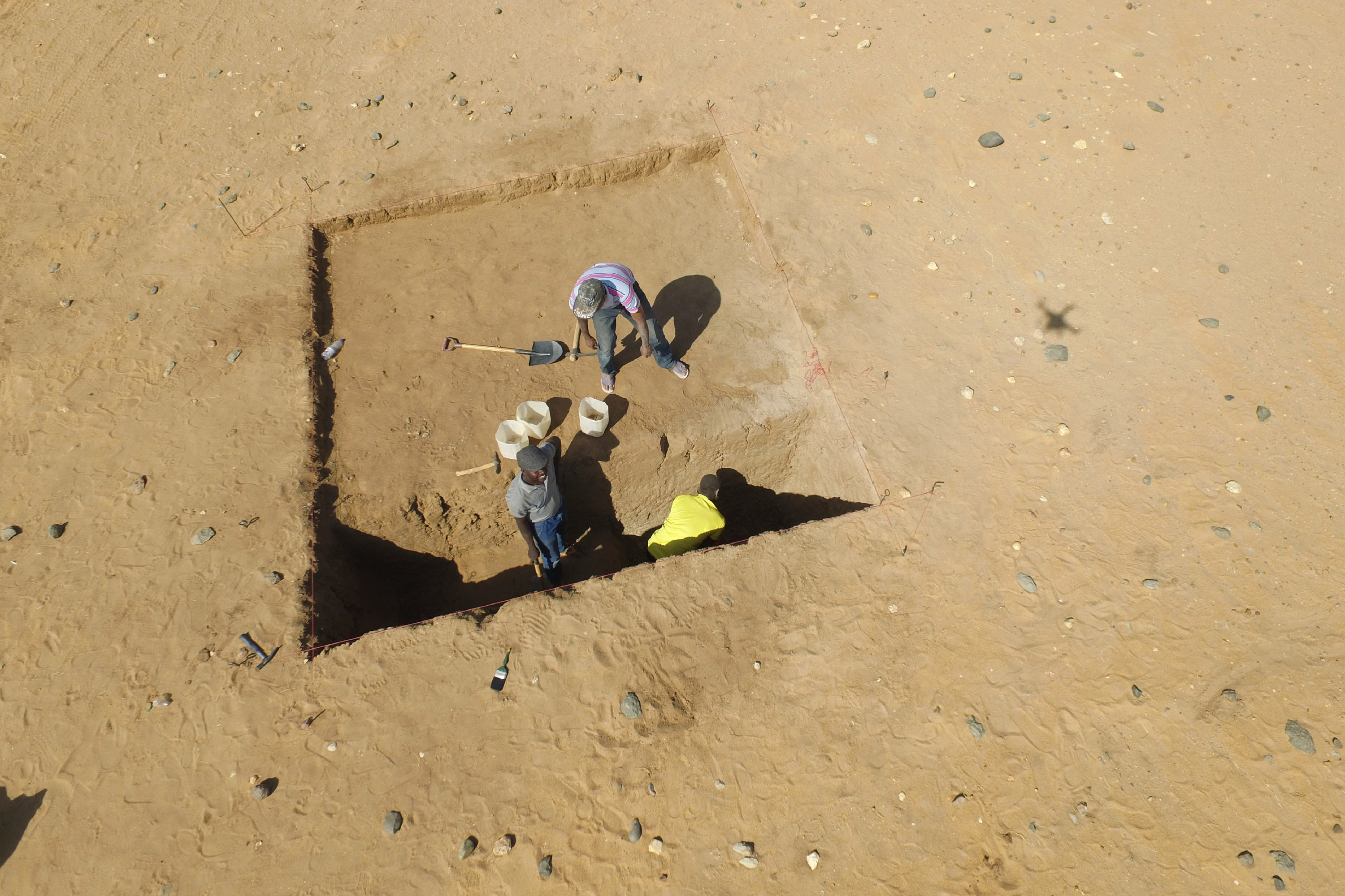
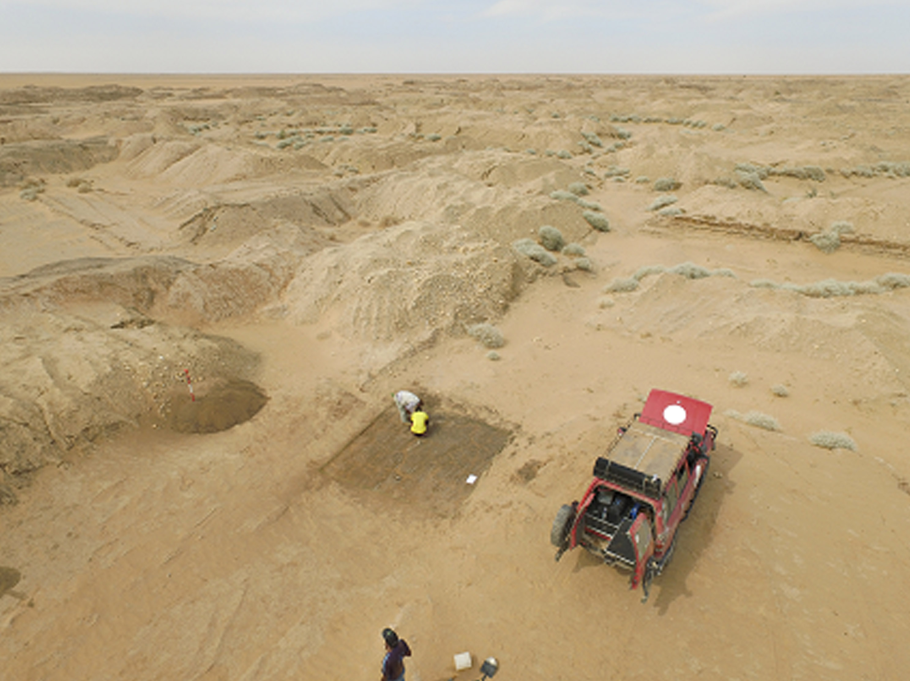
Two trenches were excavated at the site.

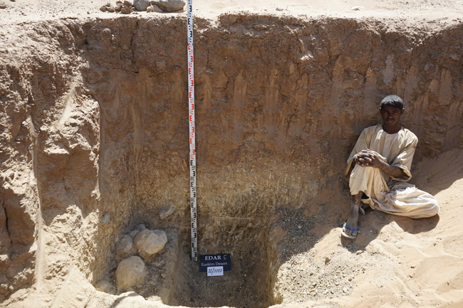
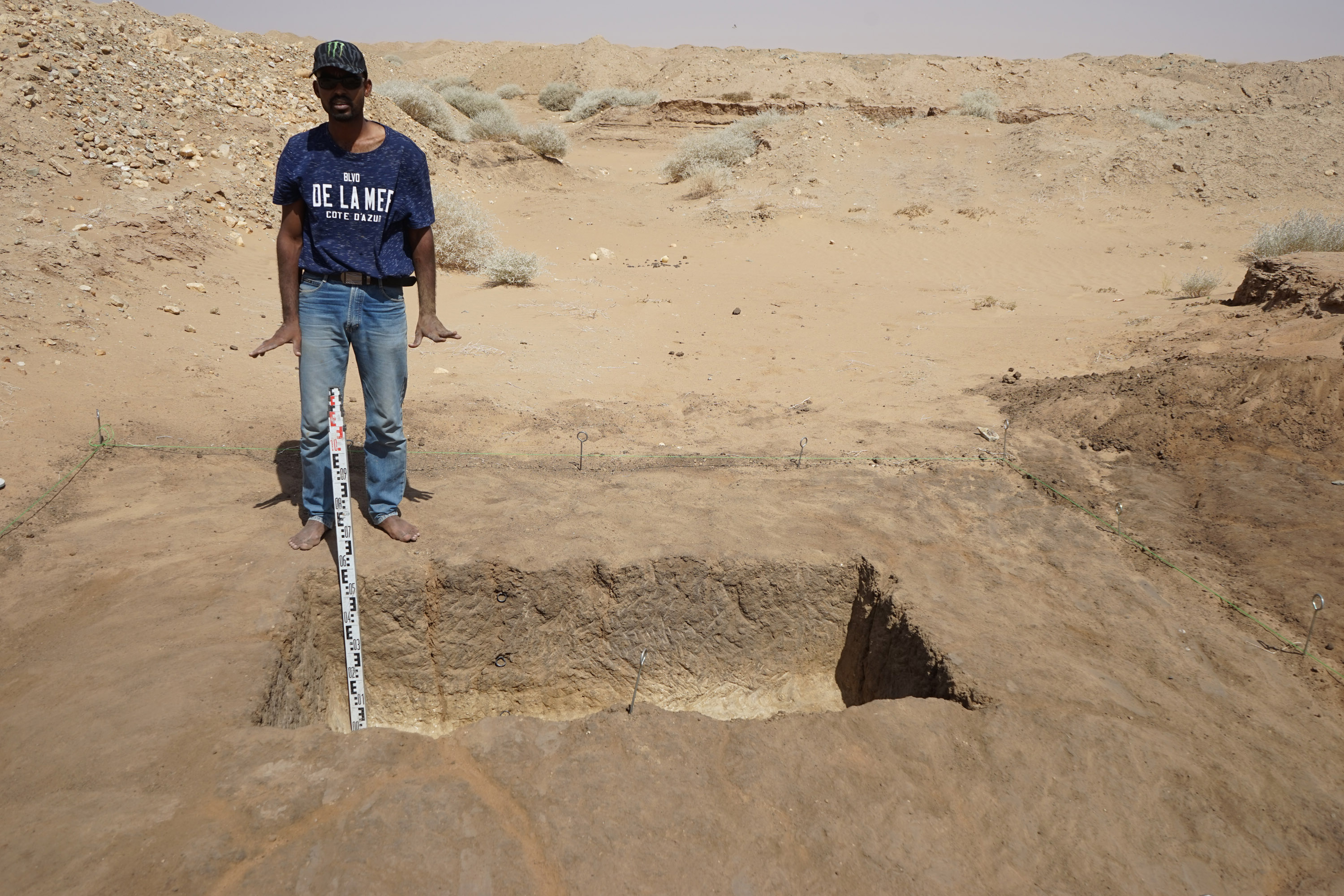
Trench I/2017 covered area of 16 square meters. Lithics were collected from the surface (ca. 200 artefacts including hand axes, cores and débitage. Further works concentrated on the area of 4 meters where the depth of 2 meters was reached. Within the sediment meagre number of Acheulean artefacts appeared. The most visible horizon of artefacts was the boundary between the brown sandy silts and a gravel layer at the depth ca. 1,6 m (Fig. 1).

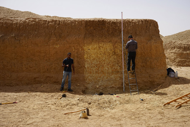
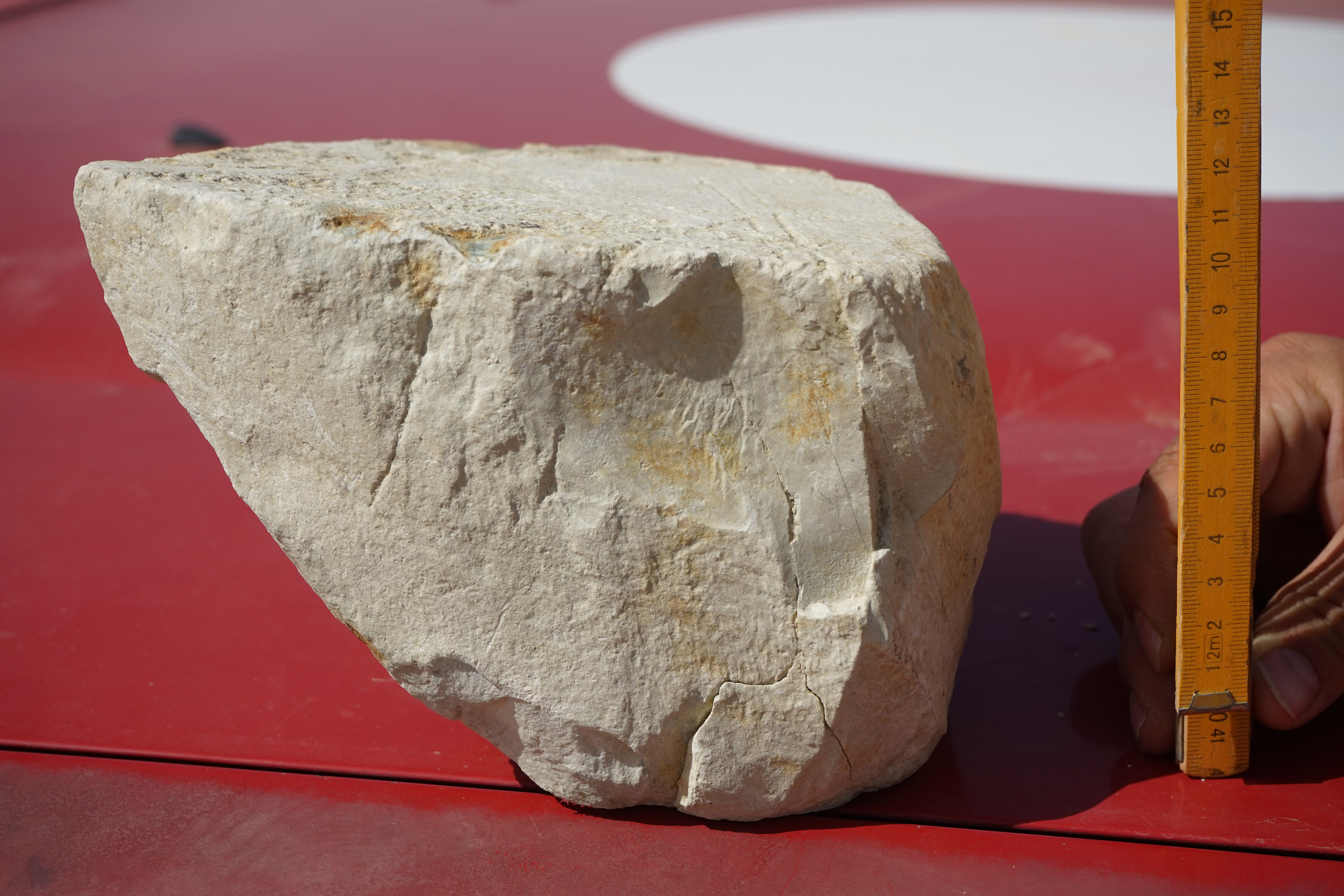
Trench II/2017, located ca. 170 m NW from trench I/2017, was and old gold mine trench just cleaned for the purpose of archaeological observations. Stratigraphy was similar to trench I/2017. Horizon of Acheulean artifacts was more clearly visible below brown silts including several hand axes as well as a big block of rock intentionally knapped. From the profile of trench II/2017 samples of sediment for AMS, OSL and PaleoMag were collected (Fig. 2).

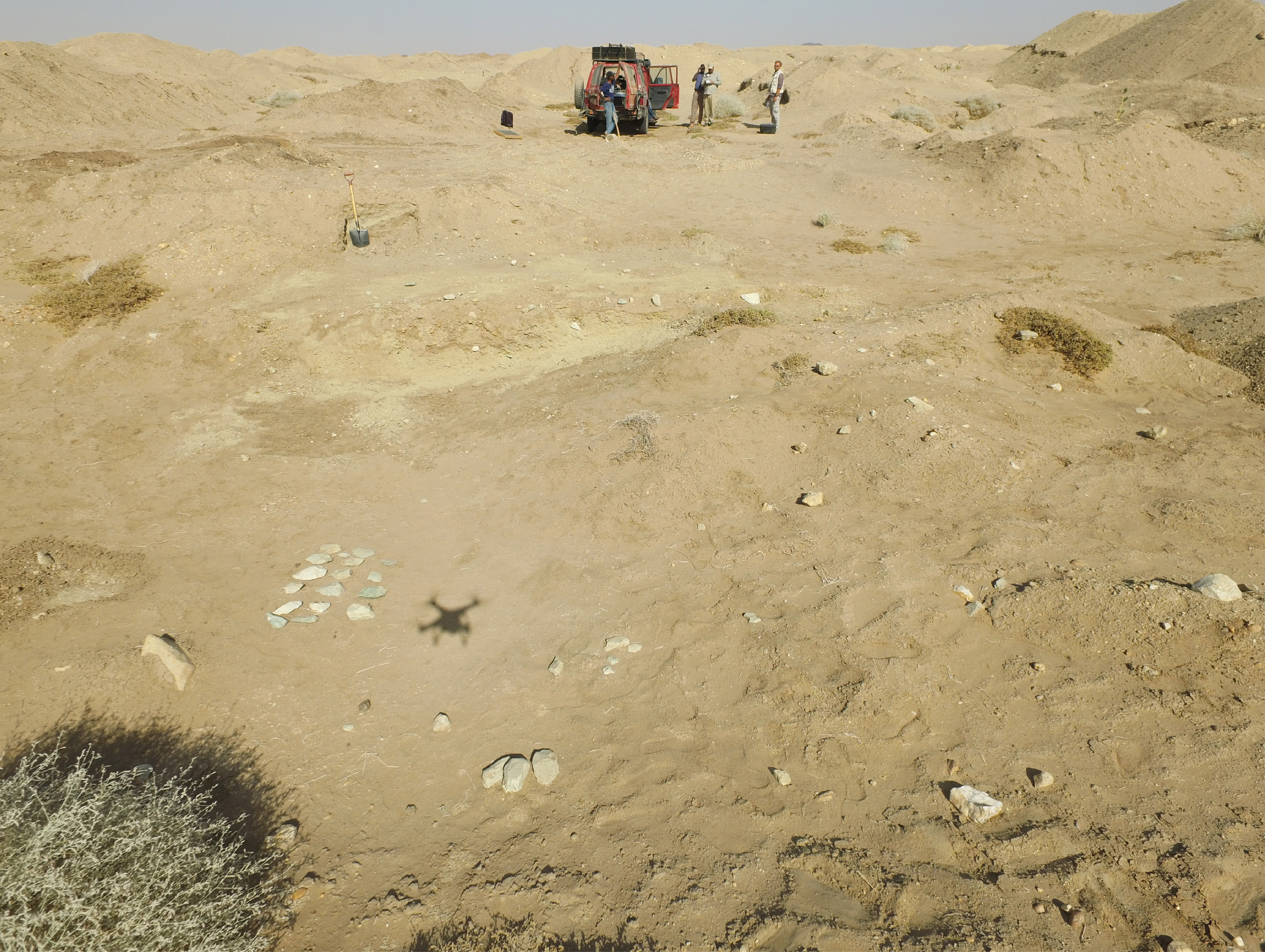
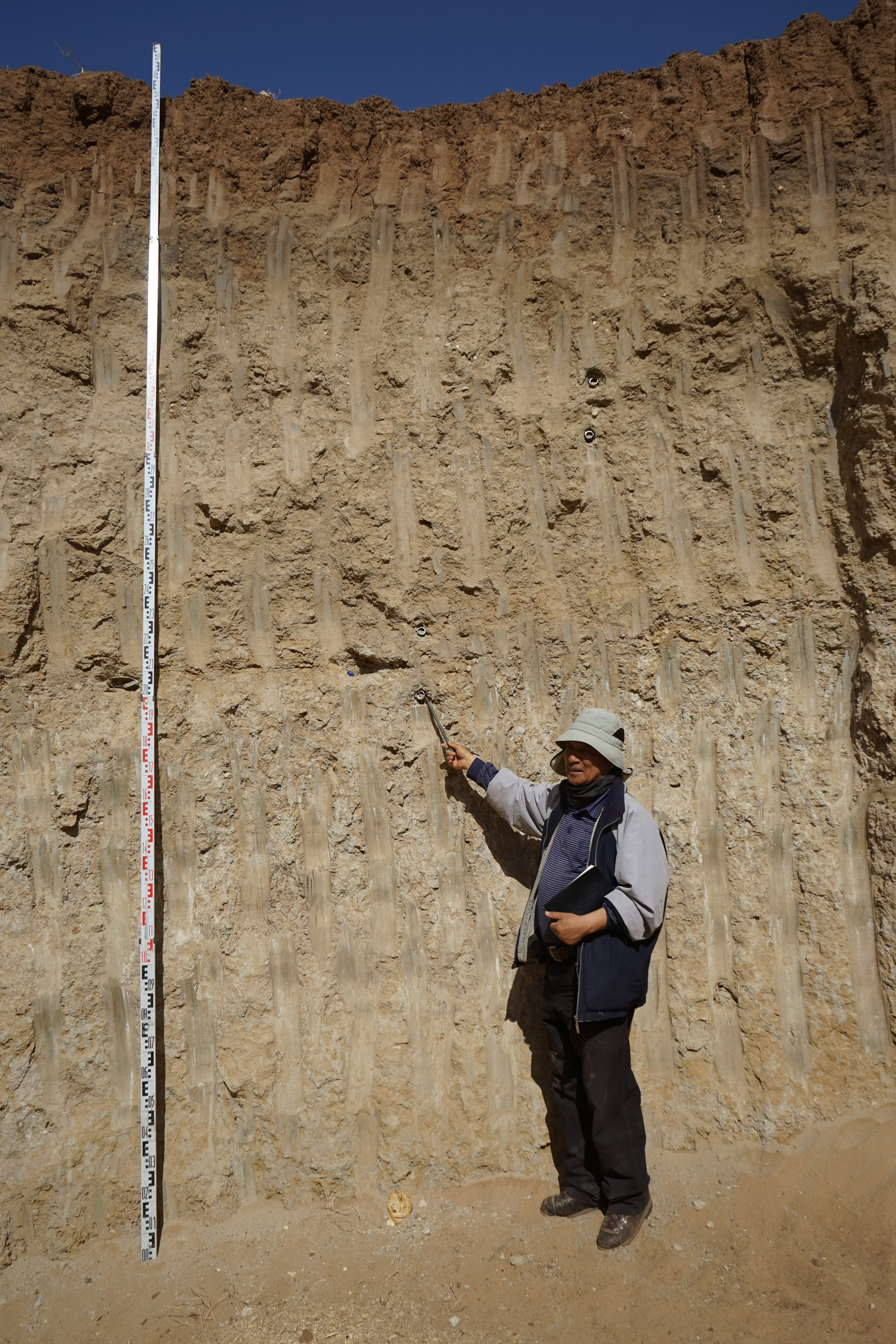
The crucial issue to be explained for the future concerning the site EDAR 6 is the mass presence of Acheulean artifacts together with MSA materials on the surface of the site just above younger sediments, which exceeds thickness of 1,5 m.

Site EDAR 7

Located in an old gold mine outcrop. Several Acheulean artifacts were found within the profiles, ca. 3 m deep. The profiles (N and E) were analyzed. Soil samples for AMS, OSL dating were collected (Fig. 3).

Site EDAR 96

Middle stone age site on the top of the hill surrounded by paleochannel  near Atbara river. Within the exposure of the channel a MSA artifacts above gravel layer were observed associated by numerous shells. Samples for AMS and mollusc shells were collected.


Site EDAR 133

Heavily disturbed Acheulean site. Many hand axes found on earth piles (Fig. 4, 5).

Despite this a preserved horizon with undisturbed, in situ artifacts was found. The surface and a profile of this part of the site was elaborated. The site will be the subject of the next season research. The artifacts appeared within the gravel layer which probably can be correlated with the one below brown silts at the site 6 and 7. Unclear relation to site 135.


Site EDAR 134

Heavily disturbed Acheulean and MSA site. Many hand axes as well as MSA artifacts found on earth piles (Fig. 6, 7).

Despite this a preserved horizon with undisturbed, in situ MSA artifacts was found. Ca. 0,5 m brown sandy silt was removed by gold miners. Within the upper part of next layer – dark brown sand silt – MSA horizon was observed. The trench I/2017 was opened on 16 square meters. Several dozen of MSA Levallois artifact were found within a good stratigraphical location. This marks the age of sandy silts building the upper part of the sediments of the area. The site will be investigated further in the following season. Samples for AMS, OSL were taken.

Site EDAR 135

The most complete profile in the investigated area. Its depth reaches 5 meters. Within the profile two horizons with artifacts were observed. In the deeper horizon, at the depth of 3 m, hand axes and flakes appeared. This is probably deeper layer than artifacts at the site 133. This is to be cleared in the future. Samples for OSL dating were collected. Another dating method for this deep located horizon is needed in the future.

Fig. 4. EDAR 133. Acheulean horizon visible in front of a group of hand axes
Fig. 5. EDAR 133. Acheulean giant core from the horizon
Fig. 6. Site EDAR 134, trench I/2017. MSA site with in situ materials from the upper part of dark brown sandy silt layer.
Fig. 7. Trench I/2017 while sampling for OSL dating

Primary conclusions

 Sites EDAR are the remains of homo ergaster (Acheulean) and homo sapiens (MSA) activities in the area. Older horizon is probably the late face of Acheulean. It evidence the remains of the migration of homo ergaster from Africa dated generally ca. 0,6 – 0,3 Ma The younger one might be the older stage of MSA.

Geological study done at the sites and the surrounding will allow the description of absolute chronology and paleoenvironmental reconstruction. Several additional dating methods are needed. Upper part of the stratigraphy will be defined by the AMS and OSL dating.

Next seasons will be devoted to recognition of the deep located horizons with hand axes recognized at sites 7, 133, 135. At the end of the field work a board informing about the area of protection was set at the site EDAR 6 (Fig. 8 below).

Fig. 8. Site EDAR 135 while sampling for OSL dating. The 5 meters-long profile is containing two archaeological horizons. At the depth of 3 m second horizon has been affiliated to Acheulean.